

Agriculture and Irrigation
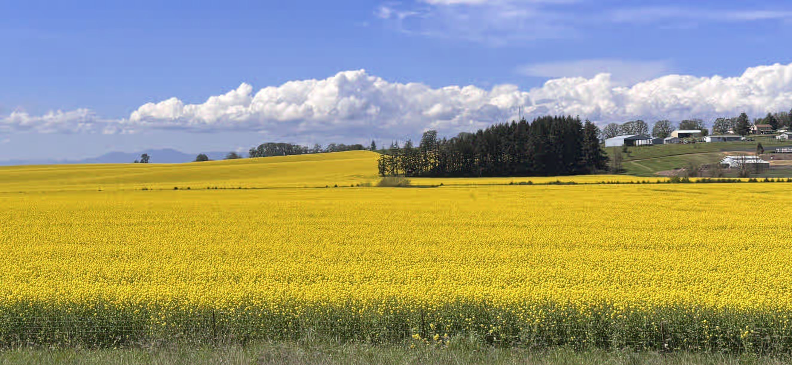
South of Salem on I-5, Marion County
OWRD has tightened groundwater allocation across Oregon. New applications are being denied at higher rates, existing uses face increased scrutiny, and development is restricted in basins where aquifer levels are in decline.
Drought frequency has increased, surface water curtailment is reaching a broader range of groundwater users, and reduced well output is being reported across multiple basins. These conditions affect irrigation capacity, acreage expansion, water right transfers, and property valuation. Assessments based on historical performance may no longer reflect current aquifer conditions.
We conduct independent hydrogeologic assessments for Oregon agricultural operations, including well yield evaluation, water right analysis, aquifer characterization, and curtailment exposure review.
Common situations
When to call us
Property acquisitions: Water right status and irrigation history review prior to closing on agricultural land.
Declining well yields: Assessment to determine whether reduced output is a mechanical issue or an aquifer constraint.
Engineering and CWRE support: Hydrogeologic analysis and technical reporting as a named subcontractor for surveyors and engineers.
Summer irrigation planning: Drawdown modeling to assess aquifer conditions before peak seasonal demand.
Initial consultation at no charge.
Oregon groundwater rules — 2024/2025
What the state now requires from agricultural operations
Oregon has ended the default approval of new groundwater permits. Applications now carry a strict technical burden of proof.
What OWRD requires
25-foot decline ceiling
Applications blocked if long-term aquifer levels have dropped more than 25 feet below historical baselines.
0.6 ft/year maximum decline
Basins with a downward trend exceeding 0.6 feet per year over a 5 to 20-year window are restricted from new allocations.
Surface water connectivity
Wells with a hydraulic connection to protected waterways or senior surface rights face denial or intensive review.
Burden of proof
Water availability is no longer assumed. The applicant must provide documented technical evidence before filing.
Beneficial use documentation
Existing rights with gaps in documented use are subject to forfeiture review under stricter enforcement.
What we assess
Aquifer stability screening
OWRD monitoring data reviewed to evaluate 20-year aquifer trends against the 25-foot and 0.6 ft/year thresholds.
Stream depletion modeling
Analytical hydraulic connection assessment using Jenkins and Hunt equations to evaluate surface water impact before filing.
Pre-application desktop screening
Basin condition review to identify applications likely to be returned under the new rules before non-refundable filing fees are paid.
NDVI and pumping record analysis
Satellite imagery, crop history, and pumping records reviewed to document continuous irrigation activity over time.
Well interference assessment
Cone of depression modeling to determine whether water level changes are attributable to a specific well or regional aquifer conditions.
All assessments are conducted by an Oregon registered geologist. Initial consultation at no charge.
Get in touchAssessment Process
Typical Project Sequence
Project scope and sequence vary depending on the nature of the water question. The following describes how most agricultural groundwater assessments are structured.
Initial Consultation
At no charge, We review the specific concern and determines what investigation is warranted before any work is scoped or quoted.
Records Review
Prior to field work, We review available well logs, pump test records, water right certificates, OWRD database records, and regional aquifer data. Existing records often define the scope of field investigation needed and reduce overall cost.
Field Investigation
Field work is conducted by our hydrogeologist directly, not delegated to field technicians. Pump tests, water level measurements, and sampling are performed on site. Methods and preliminary findings are reviewed with the client as the investigation proceeds.
Analysis
Aquifer data, water right records, streamflow trends, and applicable regulatory context are reviewed together to produce an accurate assessment of the operation’s water position.
Report
We prepare a written report presenting findings, supporting data, and recommended next steps in language accessible to non-technical readers.
Ongoing Availability
Water rights and aquifer conditions change. We remain available to assist as regulatory conditions, seasonal performance, or operational plans evolve.
Hydrogeologic Services for Agricultural Operations
Field investigation and analytical assessments addressing Oregon’s updated groundwater allocation requirements.
Water Right Records and NDVI Analysis
Pre-transaction hydrogeologic assessment for agricultural buyers, lenders, and brokers. We review OWRD records and analyze satellite imagery to document water right status and irrigation history.
- 5-year satellite NDVI irrigation history mapping
- Local monitoring-well drawdown evaluation
- OWRD water right records review
Stream Depletion Analysis
Analytical assessment of hydraulic connectivity between proposed wells and nearby surface water. Required under the 2024 OWRD allocation rules for applications near protected waterways or senior surface rights.
- Analytical modeling
- Stream Depletion Factor calculations
- Distance-to-impact analysis
Pre-Application Basin Screening
Desktop review of basin conditions before filing. We assess whether local aquifer data meets OWRD’s current thresholds, identifying applications likely to be returned before non-refundable fees are paid.
- Review against the 25-foot decline threshold
- Assessment of regional 0.6 ft/year trend data
- Data sufficiency gap analysis
Well Interference Assessment
Hydrogeologic analysis during OWRD pumping investigations. We assess whether water level changes are attributable to a specific well or regional aquifer conditions.
- Transient Theis cone of depression modeling
- Constant-rate aquifer test design and analysis
- Separation of climate-driven versus pumping-induced drawdown
Ongoing Monitoring and Technical Support
Hydrogeologic monitoring, well performance analysis, and technical support for existing agricultural operations and project teams.
Pumping Data Review and Reporting
Review and synthesis of flow meter data and utility records for operations subject to OWRD reporting requirements.
- Flow data review and formatting for state reporting
- Annual water use report preparation
- Monitoring against reported water use thresholds
Well Diagnostics and Capacity Analysis
Step-drawdown testing and specific capacity analysis to determine whether yield decline is related to aquifer conditions, pump depth, or well construction.
- Specific capacity degradation tracking
- Isolation of mechanical versus aquifer-related decline
- Pump depth and screening assessment
Technical Subcontracting for CWREs and Engineers
Hydrogeologic analysis and modeling provided to engineering firms and CWREs as a named technical subcontractor. We handle the subsurface analysis; the CWRE handles filings and final certification.
- Analytical stream depletion modeling
- Transient drawdown calculations
- Technical hydrogeologic sections for permit filings
Technical services
Hydrogeologic methods used in agricultural assessments.
Pump testing, aquifer characterization, water rights analysis, streamflow assessment, and managed aquifer recharge are covered in detail on the Technical Services page.
Schedule a Consultation
We accept project inquiries by phone or through the contact form. Initial consultations are at no charge.